Introduction
The Cropping Explorer tool comprises a series of map and graph based views of likely changes in annual crop yields associated with anticipated changes in the climate. The tool presents the likely changes for a cereal (wheat) and canola rotation.
Access to Tool
In using this tool you agree to Accept the North East CMA Terms and Conditions for use. (Click here for NECMA Terms and Conditions).
Accept and Access Tool
Cropping
Dryland cropping is one of the larger industries in area in North East Victoria, being made up mostly of family run businesses. Cropping can be a continuous or is commonly part of a mixed farming enterprise, occurring predominantly in the Indigo and Wangaratta local government areas. Cropping is commonly a cereal (wheat) and canola rotation. It is expected that the footprint of cropping will expand outside its traditional area to the South of the Hume Highway, albeit subject to land parcels of sufficient size, soil constraints (particularly soil acidity) and land price.
Of the 20 climate variables selected for presentation in this project, 13 were identified as being of particular interest to cropping farmers.
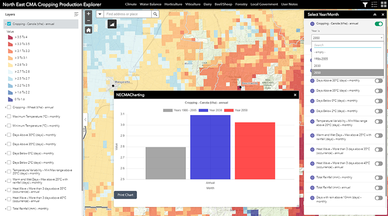
When you commence using the tool by default, the main map view will always initiate with the top layer in the Displayed Map Theme. For the Cropping Explorer this will be the modeled annual yield for Canola. And the information displayed will be based on the baseline (historic) climate data. You will be able to change the period (to 2030 or 2050), or select another ‘Displayed Map Theme’.
Fact Sheet
A Cropping Fact Sheet (in pdf format) can be accessed using the tab below.
Fact Sheet