Introduction
Spatial tools have been developed to assist agricultural sector groups, local councils, catchment managers and other stakeholders better understand anticipated changes to the climate in north-east Victoria over the next 30 years, and the likely implications.
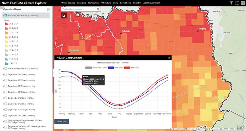
The Spatial Tools comprise a series of map and graph based views of changes in climate variables (such as mean daily maximum temperatures per month, and days per month over a particular temperature), and likely changes in water balance information and agricultural production for different commodities for a number of agricultural systems across the region.
The agricultural production and water balance information is based on modelling undertaken by Agriculture Victoria at Rutherglen using the Catchment Assessment Tool (CAT). The climate data includes the latest climate information available from CSIRO with projections provided for 2030 and 2050 compared with a baseline climate period.
The Spatial Tool has been developed as an ESRI ArcGIS Portal app where the focus has been on leveraging existing functionality that is available in the standard product rather than building new tools. This approach was adopted to ensure development efforts were focussed on data presentation and user experience rather than costly customised tools. The tools are hosted by the North East CMA.
The Spatial Tool has been optimised for use in the latest versions of modern standards-based browsers. For the best performance, it is recommend to use:
- Chrome
- Firefox
- Microsoft Edge
- Safari 11 and later
Some browsers will not support the full experience provided by the Spatial Tool.
Access to User Notes
Spatial Tool User Notes (in pdf format) can be accessed using the tab below;
User Notes Document